
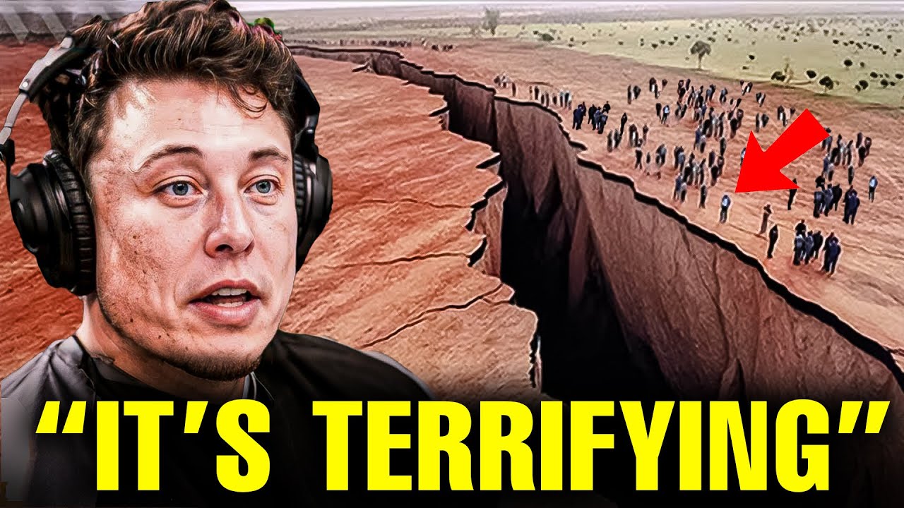
Less than two decades ago, the ground in Africa began to split, with fractures appearing across multiple countries, even dividing a man’s house in two. Since then, it has become clear that Africa is undergoing a continental rift, a process where a continent starts to break into two or more parts. This could lead to the formation of new continents, islands, and oceans, fundamentally changing our world. Why is Africa splitting? What causes the land to fracture? What are the implications for Africans and the global community? In this discussion, we explore how Africa is dividing into two continents, a phenomenon many are unaware of.
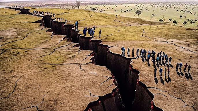 In 2005, reports and images emerged of a continental rift forming in East Africa. A continental rift occurs when a continent begins to break apart or separate into multiple sections, a natural process seen globally. All continents today resulted from rifts and tectonic plate shifts. To understand Africa’s situation, we must look back hundreds of millions of years. Earth was once a single landmass, Pangea, surrounded by one ocean, Panthalassa. Over millions of years, Earth’s crust heated, cooled, and fractured, forming the continents, islands, oceans, and seas we know today.
Though Earth appears stationary, its crust, or lithosphere, is in constant motion. The lithosphere consists of 15 to 20 tectonic plates—large landmasses forming continents and islands—that float on a molten rock layer in Earth’s core. These plates are closely joined due to the intense heat from the core and are always moving, either toward or away from each other, in a process called plate motion or tectonic shift. For instance, South America’s east coast and Africa’s west coast once fit together as part of Pangea before splitting apart to form separate continents and oceans.
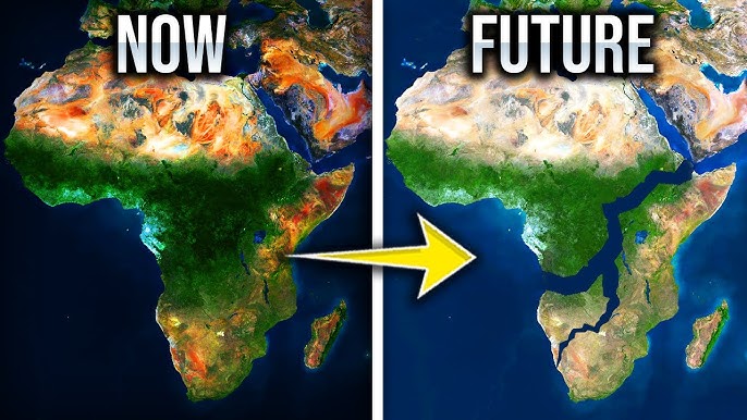
 According to NASA’s Earth Observatory, the Somalian plate in East Africa is moving eastward, away from the larger Nubian plate (also called the African plate). Both plates are also drifting from the Arabian plate in the north, meeting in Ethiopia’s Afar region to form a Y-shaped rift system. The Geological Society of London notes that this separation, known as the East African Rift, stretches 2,175 miles from the Red Sea to Mozambique. If the Somalian plate fully detaches from the Nubian plate, it could split the world’s second-largest continent in two—an event unseen since South America and Africa separated millions of years ago. However, this process would take 5 to 10 million years for a complete separation.
A partial separation could create a new sea between the two landmasses, encompassing Somalia, Eritrea, Djibouti, and eastern parts of Ethiopia, Kenya, Tanzania, and Mozambique. Alternatively, only eastern Tanzania and Mozambique might separate. Landlocked countries like Ethiopia and Uganda could gain coastlines, boosting their economies through new trade and production opportunities. Ken McDonald, a marine geophysicist and professor emeritus at the University of California, Santa Barbara, explains that the Gulf of Aden and Red Sea could flood the Afar region and East African Rift Valley, forming a new ocean and turning part of East Africa into a separate small continent. Currently, the rift grows at a slow rate of about a quarter of an inch per year—comparable to toenail growth.
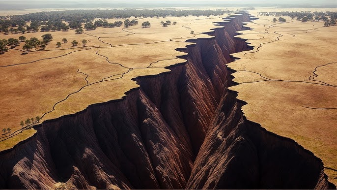
The cause of these rifts is debated, but a leading theory suggests increased heat flow from deep within Earth creates thermal bulges, visible as elevated highlands in central Kenya and Ethiopia’s Afar region. These bulges stretch and fracture the brittle crust, forming normal faults. Mantle plumes—areas of hotter magma beneath the crust—cause melting and thinning, leading to these bulges and potential volcanic activity. Large volcanic eruptions, known as flood basalts, often precede rifting, with lava flowing from fractures like water during a flood.
A key feature of the East African Rift is its rift valleys—lowland regions formed when tectonic plates move apart. Unlike river or glacial valleys, rift valleys result from tectonic movement, not erosion. Many are part of triple junctions, where three plates meet at 120-degree angles. Two arms of a triple junction can form an ocean, while the third, a failed rift or aulacogen, may become a rift valley. The Atlantic Ocean, for example, formed from a triple junction off the Gulf of Guinea, with the Benue Trough in southern Nigeria as its aulacogen. Underwater rift valleys, like those at mid-ocean ridges, form when plates separate, with magma creating new oceanic crust. The Mid-Atlantic Ridge, for instance, sees the North American and Eurasian plates drifting apart at about one inch per year.
The Great Rift Valley, stretching from the Middle East to Mozambique, is the most famous rift valley, known for its geological activity, including volcanoes, hot springs, geysers, and earthquakes. The East African Rift has two branches: the Western (Albertine) Rift, home to the biodiverse East African Great Lakes, and the Gregory Rift, named after the geologist who mapped it, extending from the Red Sea to Mount Kilimanjaro. The Afar Triple Junction, where the Arabian, Nubian, and Somalian plates meet, is a key feature. As rifting continues, the Gregory Rift could become so depressed that the Arabian Sea floods it, potentially turning the Horn of Africa into a continental island like Madagascar.
 The East African Rift offers a unique opportunity to study active rifting on land, unlike most rifts, which are underwater or sediment-filled. Rift valleys often host lakes, formed when freshwater fills the depressions. Lake Superior, for example, sits atop an ancient rift valley from a failed triple junction over a billion years ago. Lake Baikal in Siberia, the world’s deepest and oldest freshwater lake, lies in the Baikal Rift Valley, holding 5,700 cubic miles of water. The Dead Sea, in the Jordan Rift Valley, is the lowest land elevation globally at 1,407 feet below sea level, though it’s not a true rift lake due to incomplete rifting.
In the East African Rift, lakes like Tanganyika, Malawi, and Natron are notable. Lake Tanganyika, shared by Burundi, the Democratic Republic of Congo, Tanzania, and Zambia, hosts hundreds of endemic cichlid fish species. Lake Natron, a shallow, alkali-rich soda lake in Tanzania, is red due to salt-loving bacteria. Lake Malawi, the third-deepest freshwater lake globally, boasts 800–1,000 fish species, making it the richest in biodiversity.
The East African Rift’s significance extends beyond geology. Nicknamed the “Cradle of Humanity,” it has yielded hominid fossils like Lucy (3 million years old) and Turkana Boy (2 million years old), suggesting the rift’s environment fostered human evolution by driving adaptations like bipedalism due to climate shifts. The rift also holds potential as a geothermal energy source, with the United Nations Environment Program exploring steam wells to generate electricity for millions. However, volcanic and tectonic activity, rising water levels, and oil discoveries around lakes pose challenges, especially given the region’s poverty and malnutrition.
While Africa’s division may not occur in our lifetime, the East African Rift will shape the continent’s future, influencing geology, ecology, and human development for centuries to come.


